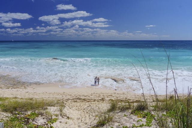
During the depths of winter, nothing warms the cockles of your heart like being on a sandbar in The Bahamas, sipping a cold Kalik, and laughing about those poor saps up north. But The Bahamas are a boater’s paradise year-round.
The Islands of The Bahamas is a nation made of hundreds of islands and cays (pronounced “keys”) starting just 50 miles east of Florida. Despite the best efforts of the internet, The Bahamas are NOT in the Caribbean (they’re in the Atlantic), but they are tropical and beautiful and exemplify many of the features held in high regard by boaters and tourists alike.
If you’ve ever dreamed of setting sail for the islands, The Bahamas are your best place to start. Here’s a look at our closest nautical neighbor, The Islands of The Bahamas.

Bahamas Boating Overview
The first thing to know about The Bahamas is that there are distinct regions within the larger archipelago, and cruising each region is very different. From north to south, the cruising regions of The Bahamas are:
- The Abaco Cays
- Grand Bahama
- The Berry Islands
- Bimini
- Nassau/New Providence Island
- Andros
- Eleuthera
- Exuma Cays
- George Town (Great Exuma)
- Cat Island
- Long Island
- Raggeds and Jumentos Cays
- Conception, Rum, and San Salvador
- Far Out Southern Islands, including Crooked/Acklins, Plana/Samana, Inagua, and Mayaguana Islands


Bahamas Cruising Conditions
Cruising through the islands is a bucket list item for many. The Bahamas are famous for their gin-clear water, luxurious white-sand beaches, and water sports, from fishing and lobstering to snorkeling and diving.
But traveling to another country is more complicated than just popping down to Florida, and crossing the Gulf Stream takes planning and know-how.
Prepping For the Trip
Before you can get there, you’ll need to do some homework to ensure everyone in your crew and your boat are ready. Getting mail and packages is impractical for cruisers in the Bahamas, so set up all your bills and banking to be completely online.
To help you prepare, we’ve compiled a handy Bahamas trip checklist for boaters.
🧍♂️🧍♀️🐕 First, the crew. Everyone needs a valid passport that isn’t within six months of expiring. Visitors from some countries may need to apply for visas. Pets need import permits, which must be signed off on by your vet in the States right before you go. Banned breeds, vaccine requirements, and health standards must be met. The process just changed, so check our write-up on the 2024 Bahamas pet travel updates.
🛥️ The boat needs to be as seaworthy and ready for anything as you can make it. Parts and supplies are more expensive in the Bahamas, and if you must import it, you’ll pay double the cost of the part between shipping, customs duty, and VAT (Value Added Tax, 20% on nearly everything in The Bahamas). Service everything before you leave, stock up on spare parts, and know how to fix as much as you can yourself.
🛒 The same preparation goes towards provisioning. Groceries and basic supplies are all more expensive in the islands. Provisioning for The Bahamas requires planning for the length of your stay and maximizing what you can get in the States that’s hard or more expensive to get in the islands.
📱 You’ll also want to plan how you will be getting internet in The Bahamas. Many use Starlink on a boat while cruising the islands, giving you high-speed internet anywhere. But there are simpler options, like working out an international roaming plan with your cell phone company (T-Mobile works best) or picking up a Bahamas SIM card from BTC or Aliv.
💵 One thing you don’t need to worry about is money: Everywhere in the Bahamas will accept US cash, and the exchange rate is fixed at 1-to-1. Credit cards are accepted at most places, except for very remote settlements or when paying individuals (for example, paying for moorings in Abaco). However, remember that your credit card company may charge you international transaction fees, and some businesses may add processing fees.
Gulf Stream Crossing
Every trip to The Bahamas, from the US at least, begins with a crossing of the Gulf Stream. The Gulf Stream is one of the most powerful currents in the world, bringing warm water up from the Caribbean, along the coast of Florida, and eventually crossing the Atlantic toward Europe. Its strongest point is right off the South Florida coast — the primary crossing area for trips to The Bahamas. Here, the north-setting current can hit 3 knots.
🌊 All that northbound water does not appreciate winds blowing out of the north. Seas pile up quickly and form unfriendly, mean-spirited, square waves that no boater wants to deal with. Gulf Stream passage planning is worthy of a masterclass (watch this space, coming soon!), but suffice it to say that the best policy to transit the Gulf Stream only on days with winds that have no northerly component (NW, N, and NE are all no-gos for most boaters). Since east winds are opposite your direction of travel, boaters usually wait in Florida for a solid forecast of S, SW, W, or dead-calm winds.
Since it sets north, most boaters follow the coast of Florida or the ICW south until they can safely cross. The most common points to depart for The Bahamas include:
- Lake Worth Inlet, West Palm Beach
- Port Everglades, Fort Lauderdale
- Key Biscayne, Miami
- Angelfish Creek, Key Largo
But plenty of other boaters make long passages and sail nonstop from Chesapeake Bay, Beaufort, NC, Charleston, SC, or points in north Florida. These routes still must plan a Gulf Stream crossing, but each in a slightly different way.
Clearing In Formalities
Your first order of business upon entering the Bahamas is to “clear in,” which means completing the formalities with Bahamas Customs and Immigration — two separate entities. Sometimes, you will go to a marina or dock, and they will come to you. Other times, you can anchor or stop at another marina and go to their office. It varies from island to island, but you cannot go ashore anywhere until you clear in at a port of entry.
Most common ports of entry from the US:
- West End, Grand Bahama
- Most marinas in Freeport/Port Lucaya, Grand Bahama
- Grand Cay, Spanish Cay, Green Turtle Cay, or Marsh Harbour in Abaco
- North or South Bimini
- Great Harbour Cay Marina, Berry Islands
- Most marinas in Nassau
- Spanish Wells, Eleuthera
- (There are others, but these are the most common landing points for cruisers coming from the US.)
The paperwork for customs should be done in advance of arriving at their office (ideally, you can start the process before you even cross). The entire thing is done on the Click2Clear website. To apply for a cruising permit, you do not have to create a log-in account — there is a separate tab specifically for cruising permits. When you have completed the application, print the form and bring it with you to Customs. Ensure you record your PCR number to give to the officer clearing you in. Customs has made a helpful YouTube video series to walk you through the process. The final step is paying the fee online with a credit card.
Once you arrive, go to Customs first. They approve the boat to stay in the country via a Cruising Permit. You can apply for either a 90-day or one-year cruising permit. The price varies depending on the length of the boat and the length of stay. For our 38-footer, we pay $300 for 90 days or $600 for one year. Again, this is all taken care of in Click2Clear before you get to the office, but it’s not approved until an officer signs it.
Immigration is next. They allow the people to enter the country and approve a length of stay. The traditional length of stay is 90 days (even if you apply for a one-year cruising permit), but the duration is at the discretion of the immigration officer. Americans can stay up to 8 months at a time, but they must request an extension after the initial time is up. The extension costs $200 per person, a new fee for 2024. Alternatively, you could fly out and come back in to restart the clock.
If you did leave via airplane, you need to have a copy of your Cruising Permit with you when you return to the country. Immigration always wants to see when and how you intend to leave.
Some ports of entry only have customs, not immigration. In that case, the customs officers will act as immigration officers and can stamp your passport for up to 90 days.
When you enter the country, you should fly a yellow “Q” (for quarantine) flag from your starboard spreader. Once approved to stay, you douse the Q flag and hoist the Bahamas courtesy flag to show that you’re legal. The courtesy flag is flown from the starboard spreader. Ensure you have it right-side up and no other flags above and below. Your US ensign goes on the stern rail, the highest place of honor on a yacht.

Bahamas Marinas and Anchorages
Many great marinas exist in The Bahamas, but most boaters who cross look to spend long periods at anchor. The islanders welcome anchored yachts, and every settlement has numerous public docks where you can land your dinghy. Everywhere else has a white sand beach to land a dinghy.
Anchoring in The Bahamas can be tricky due to the weather. You must be aware, in advance, of upcoming weather and plan for it. You must find a place safely tucked away from the wind and seas. In some cases, this might mean you simply can’t visit a destination when you want to because there’s nowhere safe enough to anchor. Or it might mean you’re stuck somewhere because the next stops along your route have less protection. Everything is based on what the weather is doing.
Even marina stays do not relieve you from thinking about the weather. Some marinas are in lovely spots but are so exposed from one direction or another that yachts should leave when the wind swings around. Such is the case with Staniel Cay Yacht Club in Exuma. It’s a spectacular place and a great facility — but you do not want to be there during strong west or north-westerlies.
Anchoring is nearly always good in sand patches. There is weed around, but the water is clear enough to avoid it. Weed can foul the best anchors, so it must be avoided if you are to get a good night’s sleep. It’s always recommended to don your snorkel and mask and visually ensure your anchor is well set, deeply in the sand.
Anchoring in creeks with strong reversing tidal currents may necessitate a Bahamian mooring — two anchors set from the bow, one into each current’s direction.

Moorings are also common in some harbors in The Bahamas. In crowded spots like the Abacos, Spanish Wells, and the ‘hurricane holes’ in George Town, enterprising locals, marinas, or businesses run the mooring fields. These are often first-come/first-serve and should be visually inspected before being relied upon (backing down on a mooring does little to tell you the quality of the equipment). There is a very real risk of gear failure with these moorings, but their prime location still makes using them desirable. In very tight harbors, also keep in mind that there is no assurance of enough space between boats, either.
Some moorings are better than others. The moorings at the Exuma Cay Land and Sea Park and the new moorings in Elizabeth Harbour around George Town are professionally installed with high-quality equipment. They are reserved through the park or online. Failures can still happen, but they’re less likely.

Island Navigation Notes
Many first-timers think the hard work and planning are over as soon as they’ve passed the Gulf Stream. Oh, wouldn’t that be nice?
Each island chain in The Bahamas is separated from the others by deep, blue water. So going from one place to the other, say from Bimini to Nassau or Abaco to Eleuthera, means planning a serious offshore passage. Those legs can be made in a day, but they need a day of good weather and favorable winds.
Unlike in the US, charts in The Bahamas often have routes and waypoints marked on them. The most common ones are from Explorer charts. These routes show you, at a glance, frequently used headings and distances for planning. Many boats follow the lines like there’s nowhere else to go, sometimes making them rather crowded.
Always keep a proper lookout, especially if you’re following a charted route or approaching a charted waypoint.

Tides and Currents
Another consideration when hopping from one place to the next is the cuts or inlets you must transit between islands. Just like on the southeast US coast, currents in the cuts are amplified, and any amount of opposing wind or swell will pile the waves up dangerously. When the cut is too rough to transit, the locals call it a “rage.”
You need to think about how the conditions of inlets will affect your departure and arrival. If you can’t get out a cut today, you might have to wait for either the tide to switch, the wind to lie down, the ocean swell to abate, or all of the above. If you make it out, those things can make getting back in at your destination a real problem. Always have a backup plan with somewhere sheltered you can get in (a north-south cut when there’s an easterly swell on, for example).
Tides are generally three feet (one meter) throughout The Bahamas, but shallow routes may require figuring out when high tide is. There’s only one tide station in the country (Nassau Harbour) and a handful of secondary sources. Navigation apps and chartplotters have built-in locations that aren’t included in the official list, but you must take the data with a grain of salt. They’re probably close, but not exact.
Boating Weather in The Bahamas
The Bahamas has two distinct boating seasons, each typified by its weather. Both seasons are busy, but they are busy thanks to very different types of boaters.
The winter season, which spans from December into April or so, is frequented by snowbird boaters who commute between the US and the Bahamas each season. Most of these folks spend summers in New England or Chesapeake Bay if they are full-timers. Or, if they’re part-time cruisers, they store their boats somewhere in Georgia or Florida during summer.
The winter season’s primary weather players are the cold fronts that come out of the US heartland. They are well forecasted, often with five or seven days’ notice before arrival. They bring clocking winds that shift the prevailing east and south-easterlies to the south and west. Finally, northwest and north winds arrive, sometimes accompanied by a line of strong squalls.
The stronger and faster-moving cold front, the stronger the squalls and winds you might experience. An approaching cold front means boaters must plan their anchoring to gain protection from all the wind directions mentioned above. Sometimes, this might mean re-anchoring as the frontal system progresses since few anchorages provide all-around protection.
Cold front season also means fewer windows to cross back and forth to Florida since each cold front brings a spell of northerly winds. Winter boaters are more likely to be in sailboats, trawlers, or others staying for a longer-term trip. Overall, winter is windier with consistent east or southeast trades and rougher water.

The summer season runs from May until December and is primarily characterized by hurricane season. The Bahamas regularly experience storms throughout the season, so the only people spending much time in the islands during this period are Florida boaters who can travel quickly.
There’s no “hurricane hole” in The Bahamas to run to should a storm threaten (although there are some very well-protected spots, they’re still on very small islands). Therefore, summer boaters are likelier to be powerboats or motor yachts that can cross quickly to get home. Overall, summer conditions are calmer with lighter winds.
Many boaters play the odds with hurricane season to get the best of both worlds: calm summer days made for beachgoing and swimming and a lack of serious danger from hurricanes. Staying in the islands through May, June, and even July is possible since — historically, at least — any storm that hits during this period is generally only a weak depression or sometimes a tropical storm, but rarely a hurricane.
Most boaters will clear out well before the season’s peak between August and October. It’s worth noting that while the probability of a storm goes down after the season peak of September 10th, the chances of that storm being severe are higher since the water is still warm late in the season. If you’re going to push your luck with hurricane season, you want to push it in the spring, not the fall. September and October are the quiet “off-season” months in The Bahamas.
Special Notes About Cruising The Bahamas
The Bahamas are the first place many US boaters go where they are truly free. Free of burdensome things like easy access to tow boats, accurate government nautical charts, correct tide and current forecasts, enforced maritime laws, and appropriately located ATONs, daymarks, and navigational lights.
Charts are important in the islands, but no government office makes them. Your best bet is those published by Explorer Chartbooks. The printed books are excellent, with cruising guide info like business data and how-tos in each volume. Explorer charts are available digitally in the Aqua Map app but lack the details of the printed cruising guide.
Navionics charts were once frowned upon in the islands for being inaccurate, and dangerously so in some places. Some, particularly the Sonar Charts, have improved greatly in recent years. The best plan is to compare Explorer and Navionics to get a rough idea of the area, then proceed cautiously and rely on eye-ball navigation.
Eye-ball navigation, visual piloting navigation, or reading the water — different terms for learning to gauge water depth from the colors.
When I first started boating in the Keys, I learned this ditty.
Brown, brown, run aground.
White, white, you just might.
Green and blue, cruise on through.
The ditty is fun, but life is a little more complicated than that — especially the green and blue parts.
When you first arrive in The Bahamas, be conservative and don’t stray too far from the published routes with plenty of depth for your draft. You may find yourself anchoring farther out than more experienced cruisers, but that’s okay when you first start. Explore in your dinghy, sound anchorages carefully, and gradually practice reading the water by color. It doesn’t take long to get the hang of it.
Do be aware, however, that clouds passing and cloudy days can mess this up. So can a bad sun angle or a wind-driven chop. Again, weather is everything when boating in the Bahamas.

Bahamas Lingo
- Clear in — Complete the formalities with Customs and Immigration
- Cay — A small island, pronounced “key” just like the Florida “Keys”
- Out Islands — The nation’s center is Nassau, where most people live. Everything else is “out” from there.
- Family Islands — Many Out Islanders leave their families to work in the big city of Nassau; hence, the Out Islands are sometimes called the Family Islands.
- Cut — Local name for an inlet or a pass between two cays
- Rage — When an inlet is impassible due to hazardous waves built up by opposing currents, wind, and ocean swells.
- Crawfish or crayfish — Local term for spiny lobster
- Conch — A historically staple food source for Bahama Out Islanders, it’s a giant sea snail. It’s pronounced “konk” — no “ch.” Yes, Sponge Bob taught you incorrectly.
- Fish Fry — Fast food equivalent, like a fish and chips stand or a street food vendor
- Cracked (i.e., cracked conch, cracked grouper) — Battered and fried
- Junkanoo — The Bahamian version of Carnival (think music, dancing, costumes, parades, and lots of cowbell) held several times throughout the year and in most areas of the country
- Rake-and-scrape — Traditional Bahamian music heard at Junkanoo
- Mailboat — Island life relies on shipments from Nassau to the Out Islands, usually made on inter-island freighters called “mailboats.” Many locals (and a few tourists) travel on the mailboats as a cheap form of transport.
- Mailboat day — The day the mailboat gets to town; it’s a big deal since it brings visitors and supplies. In the markets, the freshest produce is always found on mailboat day and sells out quickly.
Bahamas Boating Places of Interest
Major Ports and Cruiser Hangouts
- Abaco — Marsh Harbour and the outer Abaco Cays (Green Turtle, Guana, Man-O-War, Hope Town)
- Grand Bahama — West End and Port Lucaya (Freeport)
- Berry Islands — Great Harbour Cay
- Bimini — North and South
- Nassau — Nation’s capital, lots of marinas, supplies, and services
- Exuma Cays — Staniel Cay
- George Town, Great Exuma
- Eleuthera — Spanish Wells and Rock Sound
Cute Places You Ought to Visit
- Hope Town, Elbow Cay, Abaco
- Middle Berry Islands
- Andros
- Exuma Cays Land and Sea Park
- Exumas — Black Point and Farmers Cay
- Harbour Island, Eleuthera
- Eleuthera — Hatchet Bay, Governors Harbour
- Cat Island — Old Bight
- Long Island — Salt Pond
- Conception Island National Park
- Ragged and Jumentos Cays

Places to Get Boat Work Done
There are several boatyards around the Bahamas where you can get major repair work done. († denotes catamaran facilities)
- Bradford Marine, Freeport †
- Abaco Yacht Services, Green Turtle Cay †
- Marsh Harbour Boatyard
- R&B Boatyard, Spanish Wells (Eleuthera) †
- Masters Harbour, George Town (Great Exuma)
- Outside these facilities, outboard engine dealers and mechanics are available in the larger towns.
Bahamas Special Events
Here are some of the biggest events you may stumble across in The Bahamas. Remember that the country has its own set of national holidays — all the boaters are always surprised when banks and businesses are closed on different dates. A good list can be found on Wikipedia.
Regattas
The Bahamas are a nation of seafarers, as boats have connected the islands far longer than planes have. Sailing regattas are held nationwide at various times of year, with big meetups and parties as the racers tour.
George Town Cruiser’s Regatta
The Cruiser’s Regatta is an event in George Town that raises money for local schools. It’s a big party with events set up for cruisers, and there are usually some cruising boat races for fun.
Junkanoo
Junkanoo is the Bahamian version of Carnival, with parades, costumes, rake-and-scrape music, and dancing in the streets. It’s traditionally held twice a year, once after Christmas (Boxing Day) or on New Year’s Day, and again during the summer. Precise dates vary from island to island.
Resources, Guides, and More Information
Bahamas Customs Click2Clear Cruising Permit Application | YouTube How-To Series
🛒 Buy on Amazon — Explorer Chartbooks
Bahamas, Land and Sea App by Addison Chan (Download from Waterway Guide)
🛒 Buy on Amazon — Waterway Guide Bahamas Edition
🛒 Buy on Amazon — Bahamas courtesy flag (Annin Ny-Glo brand lasts the longest)
Bahamas Knowledge Base Articles
- Provisioning for The Bahamas
- Navigation Notes: Crossing the Gulf Stream
- 2024 Bahamas Pet Travel Updates
- Getting Internet in The Bahamas
- Bahamas Checklist for Boaters
- Boaters Guide to Florida East Coast
Leave a Reply