If you’re outfitting a new-to-you boat or thinking about going cruising, you may find yourself having to choose between AIS or radar. There is a lot of information on the topic, including advice from experts more knowledgeable than yours. However, as a former pilot and a cruising sailor who has used these two techniques every day on the boat for the past decade, I’d like to weigh in with what I think are the real differences.
New boaters often seem confused — as if to say, “Aren’t AIS and radar basically the same thing, or at least giving you the same information?” These two technologies get lumped together often, so you might think they’re similar. But they are, in fact, two very different things with different uses.
Here’s a look at the pros and cons of AIS or radar and some thoughts on which one might be right for your boat.

What Is AIS?
AIS stands for Automatic Identification System. It’s a special VHF radio on a boat that sends a digital signal to nearby boats with receivers. If you have an AIS receiver on your boat, you can “see” other boats on your GPS chartplotter or other display.
You can purchase an AIS transceiver that sends your position while receiving others’ positions or buy a simple receiver. The receive-only unit is slightly cheaper but doesn’t help others see you.
Big ships have fancier Class A transceivers with more functions. They’re more accurate, send updates more frequently, and include more information in their broadcasts.
Pros of AIS
Here are the good things about AIS:
- Inexpensive — for $700-900, you can add a black box send-and-receive unit or a new VHF with AIS built-in
- Shows other AIS-equipped vessels within range (20 miles for big ships, ~5 miles for other recreational vessels)
- Makes you visible to big ships and other AIS-equipped vessels
- Displays a collision warning when your course converges with another AIS-equipped boat
- Displays vessel names, making it easy to call on the VHF to work out collision avoidance at sea
- Sometimes used to display restricted areas or the location of ATONs
Limitations of AIS
But there are some really important limitations you need to know.
First, an AIS receiver will only show you vessels transmitting AIS. In areas with shipping or congested harbors, it’s easy to become complacent and forget that not every boat has this technology. You must keep this thought in the forefront of your mind because once you start trusting the little dots on the screen, you will tend to look outside and keep a proper watch less and less. It’s so easy to look out, spot the vessel you saw on AIS, and never realize that there’s another small boat nearby that you never saw.
You also must realize that the AIS units in recreational boats only send out their position every 30 seconds — they do not broadcast continuously. Further, if your AIS and VHF share a single antenna using a splitter, it’s easy to miss sending or receiving a signal…or two or three signals. That means the icon on your display may be a minute or more old — and in the wrong place! This is very noticeable when tracking a target moving at 20 or 30 knots but deceptively innocuous when looking at slow-moving trawlers and sailboats. It’s also an invisible problem if you’re relying on AIS to operate in fog. You would only realize that the icons don’t align with real life by confirming it visually, so if you can’t see the icon, it is of little help.
You might wonder why every boat doesn’t have AIS. Ships over a certain length are required to, but it’s optional for everyone else. It’s also often said that fishing boats turn their AIS off (if they bother having one at all) so as not to share their prime fishing spots with the competition.
Online AIS Tools
I recently came across some boaters who used their smartphones and a website showing AIS vessels instead of having an actual AIS on their boat. I was dumbfounded.
Sites like marinetraffic.com use VHF relay stations to send vessel AIS data online. You can view the locations of ships and boats worldwide — but only if they’re within the range of a relay station. It’s a neat toy and fun to watch your friends sail around. You could look up where Elon Musk has been keeping his yacht lately.
My problem with using this at sea is the amount of faith one would have to put in the internet and relay stations to use it for navigation. I’ve already discussed the lag when using real AIS on a boat in real-time. But now, you’re adding in any delays and lags that exist on the web connections of the relays and your download link, plus the website and hosting server’s processing power and speeds.
I simply don’t understand how you could rely upon this method or trust it in any way. It’s not a navigational tool by any stretch of the imagination. You’d be far better off to put the phone down and look outside.

What Is Radar?
Radar is a different technology that has been around much longer than AIS. Radar stands for Radio Detection and Range. It was invented in WWII as an early warning system for air attacks. It is still used for air and sea surveillance, aircraft and shipping collision avoidance, weather detection, and many other things.
Radar works by sending microwave signals outward from the antenna. Those microwaves hit objects and bounce back to the antenna, and the antenna notes the signals that return. It then shows the radar returns on a screen with its relative bearing and distance.
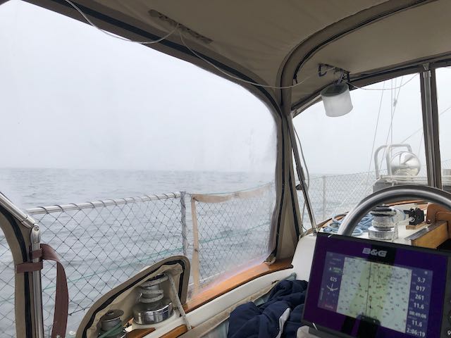
On a boat, radar has many uses. It’s invaluable at night or in low visibility when it can see what you can’t — it’s like having X-ray vision superpowers. Not only can it see other vessels for collision avoidance, but it can also see rocks, jetties, marker beacons including daymarks, buoys, islands and headlands, pilings, docks, and any number of other things. That means you can compare your radar results to your chart, matching landmarks and buoy positions to triangulate your position — radar is a supplemental navigation system.
By zooming out, your radar can also be used as a weather avoidance tool. Like weather radar, you can pick up rain falling in the atmosphere. Watching a storm over time, you can track its motion and find ways to avoid the worst of a storm.
We often use our radar to take ranges off other boats in anchorages to ensure we are not anchoring too close. Modern ‘broadband’ radar units are incredibly accurate and show great detail for navigating within harbors and in protected waters. We’ve watched single birds fly by on our radar; that’s how sensitive it is.
It’s also worth noting that radar use is dictated by the COLREGS. If you have a radar, you should use it to keep a proper watch. If you are tracking a vessel via radar, you should turn to avoid collision based on that data. There are no similar rules for AIS, and for good reason.
Pros of Radar
Here’s what radar is best at:
- Providing a navigational reference in low visibility and in the dark
- Spotting (collision avoidance) of nearly any object, from buoys or pilings to small boats
- Range from objects when entering harbors or anchorages
- Distance and movement of rain, helpful for avoiding heavy squalls
Limitations of Radar on Boats
As great as they are, radars have issues, too.
My biggest gripe with boat radar is that it’s tricky to use and takes practice. While the AIS gives you immediate, clear results, looking at a radar image is like looking through a dirty camera lens. You can sort of make things out, but you must play around and fiddle to understand what you’re seeing. You certainly can’t take off on your first day with it and expect to navigate in fog or rain safely.
All radars have a ton of functions you need to familiarize yourself with. For example, the gain adjusts the sensitivity, and there are filters to reduce the effects of rain or waves on the image. Functions like MARPA allow you to select and track targets on the screen, giving you better collision avoidance information.
Your radar is also limited by the antenna’s position and its power. The higher you place the antenna, the farther it can see. Most small-boat antennas are good for 20 or 30 miles if they’re looking for terrain or precipitation. At that range, they can’t see small boats. But, if you mount the antenna too high, it can no longer see near the boat. That would limit its use in close-quarters situations in marinas, harbors, or anchorages.
The biggest problem with using radar on a boat is getting a clear image while on a rough sea. Both the rolling of your boat and the sea state will interfere with the radar image. This can make it easy to miss objects like small boats, even with careful tuning of the image. In other words, the rougher the sea is, the bigger an object needs to be to be spotted.
Unlike an AIS transmitter, radar does not necessarily help other boats spot you. Your visibility to other radar-equipped boats depends on the boat’s profile — on how reflective it is. Radar reflectors are inexpensive ways to ensure you appear readily on other boater’s radar scopes.

Difference Between Radar and AIS
You may have noticed that the list of limitations above is significantly longer for AIS than for radar. In this case, you get what you pay for: AIS is the more limited system, while radar offers much more usability and functionality.
However, the biggest difference is that radar is an active system that only requires your antenna to work. That means that radar will show you nearly everything, while AIS will only show other boats with functioning AIS transmitters that are within range.
When combined with a chartplotter that shows your position, AIS can be extremely comforting. Too comforting, I would argue. The problem is that our mind does not immediately grasp how much information we take for granted. Is my position accurate? Is the chart accurate? Next, are the other vessel’s positions accurate; when were they last updated? Are there any vessels without AIS? We can confirm these things with pilotage or ‘eyeball navigation’ when the visibility is good. But if we start using these tools in the fog, we take a lot for granted and hope it all works out.
Once you add radar to the mix, you start adding real-world, real-time data from your position. It validates the information shown on the chart, including land, navaid locations, other vessels, and the accuracy of the AIS.
Radar is like having another set of eyes, another way to maintain a proper lookout — but these eyes have x-ray vision. Comparatively, AIS is just a fancy video game that might be disconnected from reality.

Which Is Right For Your Boat, AIS or Radar?
If you have to choose between the two, my vote is solidly in favor of radar. It’s a system that can add infinitely more safety to your night and low-visibility passages while also providing excellent collision avoidance details for ANY vessel, not just other AIS-equipped ones.
That said, AIS is a wonderful tool to have. It is extremely comforting to know the course, heading, speed, and point of closest approach of big ships when sailing offshore. It’s also handy on inland routes when you can see barges coming around the corner before you’d otherwise know they were there. And it makes VHF a breeze since everyone can see everyone else’s names — no more “White Sailboat off of Wilson Point” calls (wherever Wilson Point is, no one knows; we’re not from around here!).
You can install an AIS unit yourself, and it will usually be a matter of plug-and-play with your existing VHF antenna and chartplotter. Many newer VHF radios come with built-in AIS transmitters or receivers, so it might be as easy as upgrading your radio to a newer model. AIS units are typically under $1,000 total.
Radar, on the other hand, must be of the same brand as your chartplotter (unless it has its own display) and requires proprietary cables and a hefty mount to hold the $1,500+ antenna. Putting in a mast or mounting it on an existing mast is a big project and even more money. All told, a radar install will likely be $2,500 (or more) in parts plus labor, and that’s if you can reuse your existing chartplotter.
Radar also consumes more power. The AIS transmitter is low-power and uses a negligible number of watts. Although modern radars are much more efficient than their predecessors, they still consume 5 or 10 times the power of AIS. However, most radars have a sentry setting that cycles them on and off for set amounts of time to save power while still providing collision avoidance at sea.

There’s no blanket answer to which one is right for you; it’s yet another grey area where the answer is that, oh, so disappointing refrain, “It depends!”
For AIS, if you’re upgrading your VHF, there’s no reason not to add an AIS-equipped unit — it will only cost you a few hundred dollars extra and will have virtually no extra parts or installation.
Who needs radar? Any boater who wants to operate year-round — or use their boat extensively on overnights without worrying about lay days due to fog or low visibility — can greatly benefit from having radar. If they limit themselves to daylight, fair-weather-only cruising, most cruisers probably don’t need it.
Leave a Reply