Arriving by boat to the coast of Maine for the first time is like landing on an alien planet. At least it was for this Florida boy, who had never been to the state before by land or sea.
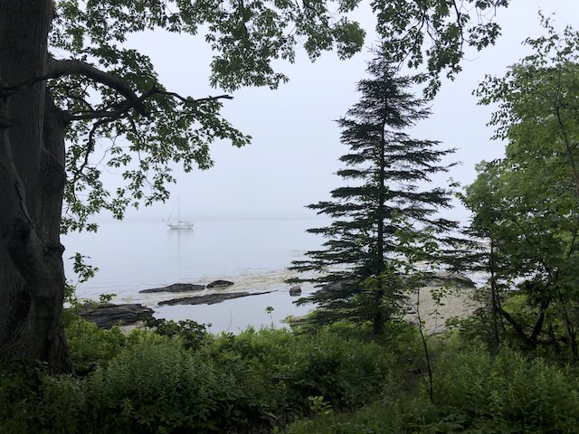
Everything is different in Vacationland: You don’t worry about sandbars, you worry about rock ledges. There aren’t so many bottlenose dolphins, but harbor porpoises are everywhere. Seals pop their heads out of every anchorage. The lobsters have claws. The tides are significant, the weather is different (foggy!), and the scenery is spectacular.

Sailing in Maine is a once-in-a-lifetime experience, a must-do for any cruiser. Even if “cold weather” boating isn’t your scene, the 70-degree days of July and August are absolutely divine while the rest of the nation swelters. There are little islands to explore and wander, hundreds (thousands?) of anchorages to discover, and amazing towns to ramble through.
Here’s a look at cruising the Maine Coast to inspire your next adventure north.
Experienced boaters write these boater’s guides to help introduce and familiarize cruisers with new areas before visiting. What follows is an overview of the cruising conditions, special notes, weather patterns, where to stay, and what to do when visiting. At the bottom, you’ll find a list of resources and references for more information about cruising here.
Maine Boating Overview
The coast of Maine can be divided into five cruising areas. Each has a unique set of characteristics.


Maine’s Southern Coast
The southern coast starts at the New Hampshire state line, at the Piscataqua River with the towns of Portsmouth, NH and Kittery, ME. It then follows the sandy beaches north until you get to Portland.
While you pass through a few ports of call, most cruising takes place farther north.
Casco Bay
Casco Bay includes the expanse of water and hundreds of islands that begin north of Portland and go until the Bailey Island/Harpswell area.
Portland is the biggest city and boating hub on the Maine Coast. There are several big marinas, and many more mooring options. It’s a busy, waterfront, port city with lots going on and every service you might need. Many locals also keep their boats around Falmouth, a northern suburb of Portland.
While no other major towns are on the coast past Portland, the little towns along the coast are all a quick drive from Brunswick. Many of the islands in Casco Bay have regular ferry service and are home to communities and summer resorts.
Maine’s Midcoast
The Midcoast has long, narrow rivers and bays flowing north to south. Between the rivers is a jagged, exposed weather coastline. But the rivers provide excellent cruising, with journeys up the rivers offering access to little port towns and amazing, secluded anchorages. It’s less busy than Casco or Penobscot Bays.
A popular stop along this section is Orr Island in Harpswell, on the outskirts of Brunswick. Boothbay Harbor, the area’s primary port city, is farther east.
Penobscot Bay
Penobscot Bay starts around Rockland and extends north to Mount Desert Island. From Rockland, you can stay inside the islands in mostly protected waters, pass through a few popular sailing routes, and come out the other side at Acadia National Park.
Penobscot is where the mountains of Maine start. It’s hilly before this, but the scenery gets progressively more rugged and exciting as you go farther east.
Penobscot is home to some of the state’s most popular spots and ports, including Rockland, Camden, Castine, and Stonington. Each little island has fishing harbors to visit, and the islands provide an endless supply of bays and harbors in which to anchor.
Personally, Penobscot reminds me of cruising the Abacos. Rockland is like Marsh Harbour, the spot you keep returning to reprovision. Then you spend weeks wandering around the islands and exploring the little towns and anchorages.
Ferries run from Rockland to Vinylhaven and some other Penobscot Bay islands. Deer Isle, one of the biggest islands in the bay, is connected by a tall suspension bridge.
Mount Desert Island and Acadia National Park
Mount Desert Island (MDI) is the home of Acadia National Park, the US’s busiest national park. But you’ll hardly notice them when you arrive by boat. The island is connected to the mainland by a low bridge near the town of Ellsworth.
During the summer, a free shuttle bus (courtesy of LL Bean, of course) serves the entire island. This allows cruisers to explore the park’s landside without renting a car. It also allows one-way walking trips through the island’s many trails and carriage roads.
MDI has the highest point on the Eastern Seaboard: Cadillac Mountain at 1,530 feet above sea level. The park service also points out that, because of the elevation, it is the first place in the US where you can see sunrise each morning. But the view from Cadillac is spectacular any time of day (but it’s also crowded).

There are three cruiser hangouts on MDI: Southwest Harbor and Northwest Harbor on the island’s southwest corner, and Bar Harbor on the east side.
Downeast Maine
Few cruisers continue past MDI, so it’s much quieter “Downeast.” Towns become farther apart, and the tides get progressively higher.
There are only small towns until you get to Eastport.
Maine Cruising Conditions
Maine is a cruising sailor’s paradise. Not only is there a lifetime’s worth of places to explore, but the summer breezes freshen every afternoon and the protected areas between islands make for wonderful reaches.
What’s better? Maine is a sailing state where beautiful, old-world boats rule the day. People appreciate the benefits of classic boats with stunning aesthetics. Maine is the home of Hinkley, Sabre, and Able boatbuilders, after all.
That’s not to say motor boaters won’t have plenty of company. It’s no accident that Hinkley also makes some of the most beautiful powerboats on the water. The classic Downeast design is a take on the Maine working lobsterboat. Cruising the islands and anchorages in Maine by trawlers is perfection.
Maine Marinas, Moorings, and Anchorages
Like many states in New England, Maine has many more boats than marina slips. The state leans heavily on moorings as an alternative for boat storage and transient accommodations. Slips are expensive, although transient rates are not prohibitively so.

Moorings are easy to come by — often everywhere you go. Not only do marinas have mooring fields, owners sink their own moorings. Sailing clubs have moorings set up at their favorite destinations for their use. There are basically moorings everywhere you go, but there’s still plenty of room to anchor, too.
Marinas offer transient moorings, which give you access to the marina amenities and dinghy dock. Mooring rates are in the neighborhood of $40 a night. A few towns have complementary visitor moorings.
There’s an interesting cultural attitude in Maine regarding using other people’s moorings. The locals will pick up any available ball unless it’s marked as taken. To be polite, they stay aboard the boat to ensure no one shows up. If someone does, they just move on.
There are a few problems with this, but the primary one is that you cannot know what sort of ground tackle the mooring rests on as a visitor. In Maine, moorings are sunken granite stones of various sizes and weights. Bigger rocks are needed for bigger boats, so it’s impossible to know what size rock a ball is attached to.
There are plenty of places to anchor in Maine. Due to the large tide swings and deeper waters, you must get used to putting out more scope than you might in other locations. It’s not uncommon to need 200 or 250 feet, considering you sometimes anchor 25 feet at low, with a 12-foot tide. Holding is usually good in mud in most anchorages, but you may sometimes wind up over rock. Setting the anchor well is vital to ensure you’ve found the mud. Kelp is also common, and it can foul some anchors.
Navigation Notes for Maine Cruising
The tide swings and rocky coasts mean rock ledges are your new boating enemy number one. The good news is that rocks don’t move like sandbars do, so they’re always right where the chart shows them.

The bad news is that the charts aren’t 100 percent accurate. If you see the rock symbol, you want to give it a wide berth. You also want to keep an eye out for those Active Captain markers that warn of unmarked hazards.
Generally, if you keep to the center of channels and anchorages, you won’t discover any surprises. It’s when you’re poking around on the edges or gunk-holing that you can get into trouble. Be conservative when you first arrive at a new place.
It’s always shocking to arrive at high tide and watch the rocks appear as the tide goes down. Remember, though: Just because the tide exposed some rocks does not mean it exposed all the rocks—there are even more rocks down there!
Maine Tides and Currents
As mentioned previously, Maine has bigger tides than you might be used to. The range gets bigger the farther east you travel.
In Portland, the average tidal range is about 11 feet. In Bar Harbor, it’s about 13. By the time you’re in Eastport, it’s about 22. Remember, the Bay of Fundy is known for having the highest tides in the world, about 53 feet at the head of the bay.
Despite the large tidal range, currents are seldom a significant factor when planning a Maine cruise. The tidal flow in and out of rivers and bays is noticeable but usually only around a knot.
The exception is if you are planning trips far up the river, such as up to Bangor on the Penobscot River. Then, you’d want to plan the currents carefully for the best speed (especially in slower boats).
Maine’s Boating Weather
Maine’s boating season lasts from May to October. Most cruisers visit only during the peak season, which runs from around Memorial Day (late May) to Labor Day (early September).

Early summer is typically more foggy, rainy, and cool. The best bet for sunny days is July and August.
Most boaters locally haul and store their boats for the winter just after Columbus Day (early October). They don’t put them in again until late April.
It’s really not feasible to stay on a boat in Maine during the winter — most harbors ice over, docks and moorings are pulled from the water, and it’s very cold indeed. Only the hardiest of souls attempts it, and even then they need to shrinkwrap the boat and take special precautions. Finding a slip for the winter is not easy.
Special Notes About Boating in Maine
Here are a few thoughts particular to cruising Maine waters.
Hiking and Landing on Islands in Maine
One of the best parts of cruising Maine is that there are plenty of places to put ashore and explore. This is where so many other cruising areas fail. Maine has many fantastic places to get off the boat, stretch your legs, and let the dog have a land sniff.

Many of the little islands around the state are open to the public, offering beautiful hiking trails and stunning scenery. Some also have campsites for overnight stays.
The trick is figuring out which ones you can land on and which you can’t. Even private islands sometimes allow the public to walk the trails and enjoy the island if you respect their property and privacy.
There are two resources that are a great help: MITA (Maine Island Trail Association) and the Maine Coast Heritage Trust. The MITA app collects most of the info on islands and makes it easily accessible.
In addition to these organizations, you’ll encounter preserves and other lands owned by local conservation trusts. The AllTrails app is a good resource, too. It collects user data about great walks and can direct you to the organization that owns the land. Then, you can access official maps and guides online.
Finally, just poking around Google Maps/Google Earth is a good way to find preserves and walking trails. A good cruising guide will also help point you in the right direction.
Maine Fishing Gear
Ask any boater who’s been to Maine, and one of the first things they’ll start talking about is the lobster pots and fishing gear. The trap floats are everywhere, often so close together as to be unavoidable.
Boats with exposed running gear need to be extra cautious. It is pretty much impossible to boat in Maine and not run over one or two in a season (and that’s being very careful!).
There’s no good way to avoid the traps in Maine. You can try spending more time offshore, but they go all the way out to depths of 300 feet or so. They get more prevalent nearer fishing villages, but they really are everywhere. Don’t figure you’re safe being in a channel or a heavily trafficked route, either.
As you head east and the tide swings increase, toggles become more common. Toggles are a level of lobster pot fun you didn’t even know existed. A toggle is a second float, flowing downstream from the first with a line attaching it that floats just below the surface.

It’s common to find toggled pots and pots without toggles in the same area, so it’s impossible to know which are which. And there are times when they’re so close together that you can’t pick up what’s the main float and which is the toggle, meaning you’re likely to pass between a primary and a toggle float at some point. With exposed running gear, this is nearly guaranteed to foul your prop or rudder.
There’s a reason that Maine boats have caged props or full keels. These allow the ropes to slide off without getting caught. If you’ve got spade rudders, saildrives, or a deep fin keel, you’ll need to have a way to get fishing gear off the prop. Many boaters install line cutters on their props, but these are a last resort since it costs the fishermen hundreds of dollars for each lost trap and the trap continues killing as long as it’s on the bottom (ghost traps).
You should definitely keep your SeaTow or BoatUS membership current should you need a tow. But you’ll also need a thick wetsuit, mask, fins, and dive knife, just in case.
Dealing with Fog
No matter the month, boating in Maine is dealing with fog. At the bare minimum, you need a sound signal, a radar reflector, and nerves of steel. And plenty of patience to stay in port a few days until a clear day.

Radar and AIS are also helpful. AIS is great for seeing other cruisers and big ships, but it is not a replacement for radar. The lobster boats do not have AIS, and they’re the biggest concern. Unfortunately, most boats do not sound the legally required signals when the fog rolls in.
You’ll also want to be proficient in using your radar because there are many workboats moving around. They move erratically, darting from trap to trap at high speed, making it challenging to figure out what’s going on through the radar scope.
For maximum fun, it pays to play the weather and only move on clear days. But the fog can settle in quickly and stay awhile, so sometimes you wind up out in it unexpectedly.
Maine Lingo
Talk like a local. (Or at least figure out what’s going on…)
- Lobster roll — The Maine meal; the must-have local specialty. The regional style is to serve it with a light mayonnaise sauce and on a toasted bun, which is lovely. Just my opinion.
- Lobster pound — Little takeaway restaurants along the coast that serve lobster rolls for tourists and whole lobster (sold by the pound?) for the locals. Often operated at the docks by the co-ops or seafood markets themselves.
- Lobster pot — Trap
- MDI — Short of Mount Desert Island, the home of most of Acadia National Park.
- Fjard — Sommes Sound on MDI is a fjard, like a fjord only smaller. It’s a long, narrow sea inlet carved by glaciers with towering mountains around. Fjords have taller mountains and deeper channels (think Chile, New Zealand, and Norway), while fjards are shallower with slightly more rounded mountains.
- Downeast — A general term to describe Maine when you’re in the rest of New England. But, once you’re in Maine, it describes the bit of coast “way down east,” past MDI. It also describes a style of vessel, based on the Maine lobsterboat.
- Reversing falls — Since the tides are ten feet or more, there are several places where water flows into interior bays at high tide and goes out and leaves them dry at low tide. The effect is a flowing river that reverses with the tidal current, or ‘reversing falls.’
- Thoroughfare — The local name for a sailing/boating route between islands, usually heavily trafficked since it’s a connecting route. Examples are the Deer Isle Thoroughfare and the Fox Island Thoroughfare around Vinylhaven.
- Mainers — People from Maine, duh!
Maine Boating Places of Interest
Major Ports and Cruiser Hangouts
- Portland area and Casco Bay
- Boothbay Harbor
- Rockland & Camden area
- Penobscot Bay
- Mount Desert Island, Southwest and Northwest Harbors + Bar Harbor
Cute Places You Ought to Visit
Maine has far too many places to list, and any exploring you can do will be rewarded. If I had to choose one area to focus on during my first trip, it would be Camden and the islands of Penobscot Bay, including some time on MDI.
- Jewel Island — A small hiking island on the outskirts of Casco Bay
- Boothbay Harbor — Picturesque, quintessential Maine seaside town.
- Camden — A beautiful harbor town with a fabulous marina complex (Lyman-Morse, one of the nicest marinas on the East Coast, in our opinion) and lots of rental moorings. Food, shopping, wandering, mountain hiking, and great views.
- Vinylhaven Island, Winter and Seal Harbors — Popular gunk-holing spot in Penobscot Bay. Some sandy bars exposed at low tide make for great exploring and walking.
- Isle Au Haut — most of the island is part of Acadia National Park, but it’s a ferry ride away from the Deer Isle town of Stonington.
- Acadia National Park — Totally worth it, from hiking around the harbor towns to riding the shuttle and exploring the touristy hotspots. You must see the view from Cadillac Mountain at least once! A trek to Winter Harbor and the Schoodic Peninsula is also worth your time.
- Sommes Sound area and Cranberry Islands — Wonderful boating around the southwest corner of MDI that’s quieter than Bar Harbor. Sommes Sound is America’s only fjard (a smaller fjord).
- Buckle Harbor — Trails and picnic island, near Swan Island and MDI.
Special Events
The towns in Maine are big on annual festivals that draw tourists in for lobster, live music, and nautical fun. Rockland and Camden, in particular, are hotspots for seaside festivals in the summer.

Here are just a few, but there are lots more in towns all along the coast.
- Rockland Lobster Festival (End of July)
- Rockland Schooner Races
- Rockland Blues Festival
- Camden Classic Cup Sailing Regatta (End of July)
- Camden Windjammer Festival (End of August)
Places to Get Boat Work Done
Most Maine towns have full-service marinas and boatyards. Although prices are high compared to other places in the country, they are on par with those of other New England yachting centers.
Maine has some of the best boatbuilders and most respected yards, such as Lyman-Morse in Camden and Hinkley in Southwest Harbor.
Resources, Guides, and More Information
The primary resource for boating in these waters is the Cruising Guide to the Maine Coast by Taft and Rindlaub (currently in its seventh edition). Buy it on Amazon or directly through the publisher. You probably don’t need the most recent to get a ton of great information from it.
Note: Each edition of this book seems to sell out before it is reprinted. If you ever see a copy on the marina free shelf, snatch it up!!
Another fabulous resource is online and completely free from the Cruising Club of America:
CCA’s Online Cruising Guide for Maine
Finding places to hike on islands:
- MITA (Maine Island Trail Association) — download the app
- Maine Coast Heritage Trust
- Acadia National Park
Facebook group:
Note: Each town also has its own local community page or group on Facebook.
Boat Life Acadmey Boater’s Guides:
Leave a Reply